
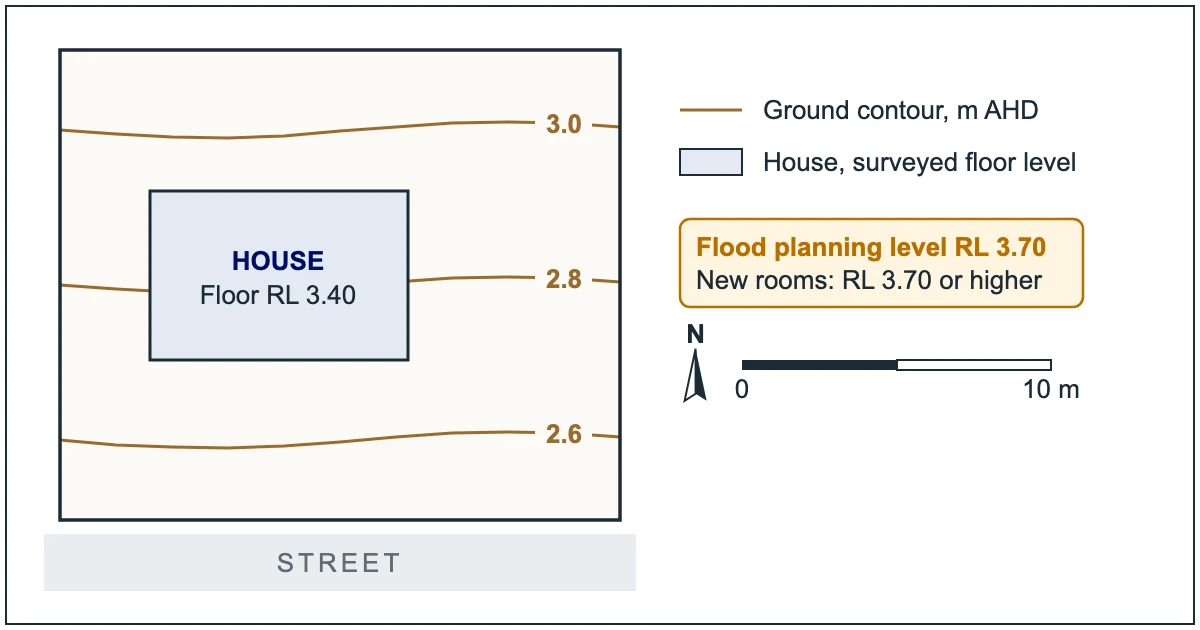
On flood prone land in Newcastle, the floors of occupiable rooms need to sit at or above the flood planning level: the flood level plus a safety margin called freeboard. The flood map and council's Flood Information Certificate give you the flood level. They do not tell you where your floor or ground sits. That takes a survey on the same height datum council uses, the Australian Height Datum (AHD).
This guide follows the steps in order: checking the map, reading the terms, ordering the right certificate, working out the floor level council expects, and turning a flood level into a floor height your designer can use. It covers the City of Newcastle area, with a short note for Lake Macquarie. It is general information, not planning advice.
Key takeaways
- City of Newcastle says flooding affects up to one third of all properties in Newcastle. Its flood information viewer shows whether your address is in a mapped flood area.
- On flood prone land, the Newcastle Development Control Plan 2023 sets floors of occupiable rooms no lower than the flood planning level: the planning flood plus a freeboard that is generally 500 mm.
- Small additions to an existing building can fall outside the flood section under a "minor additions" exception, with limits set by the existing building's area.
- Council's DA lodgement requirements say the certificate must have been issued no more than 12 months before you lodge.
- Council's flood levels are on AHD. Its certificate notes say they can be compared with ground levels a surveyor measures on the same datum.
- A survey of the site's levels is what turns council's flood level into a floor height for your plans.
Listen to this article
Narrated summary (2 min 34 s). Open the transcript to follow along.
Show the transcript
Is your address flood affected?
Start with council's map. City of Newcastle's flooding page links to its flood information viewer, where you can look up an address and see the mapped flood extents. Council treats land within the probable maximum flood (PMF), the largest flood NSW guidelines recommend identifying, as flood prone land, and says flooding affects up to one third of all properties in Newcastle.
The map is a starting point, not an answer for your plans. It shows whether the property sits inside a flood extent. It does not give a level for your lot, and it does not tell you whether your floor is high enough. Those come from the certificate and a survey.
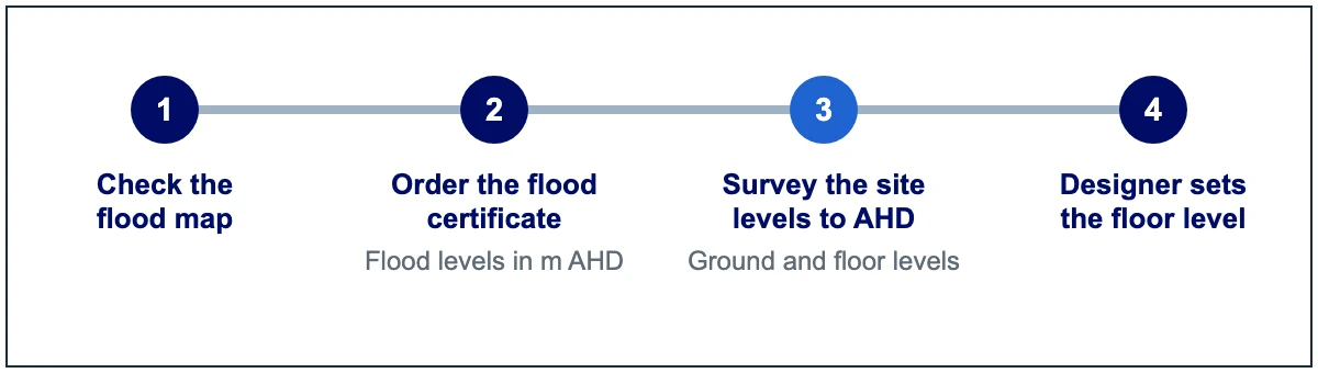
What the map and the certificate are telling you
Three terms come up on the map and the certificate:
| Term | What it means |
|---|---|
| 1% AEP flood | A flood with a 1% chance of happening in any year. It used to be called the 1 in 100 year flood. |
| 1% AEP in 2050 | The same flood allowing for climate change to 2050. Newer studies use it as the planning flood. |
| PMF | The probable maximum flood: an extreme event used to define flood prone land and assess risk to life. |
Which rules apply depends on your area's flood study. The DCP has two versions of its flood section. Section B1(b) applies where flood mapping was prepared after the 2019 Australian Rainfall and Runoff guidelines, including the Throsby, Cottage and Styx creek catchments, and uses the 1% AEP in 2050 as the planning flood. Section B1(a) applies to older mapping and uses the 1% AEP. In the Throsby, Styx and Cottage Creek area, council's certificate notes apply B1(b) to local flash flooding and point to B1(a) for ocean and riverine flooding. Your certificate tells you which levels apply to your property, so never borrow a figure from another suburb.
Which Flood Information Certificate to order
Council issues three kinds through its online application:
- General certificate: for flood information about a property, or when you are preparing a development application (DA).
- Complying development criteria: when you are applying for a complying development certificate (CDC) and need to confirm whether the property meets flood-related planning requirements.
- Additional complying assessment: only if council has asked you for it. Council says most people do not need it.
Council says a general certificate is typically issued within 10 to 14 business days, and an urgent one typically within 2 business days for an extra fee. Fees depend on the application, and the online form gives you an estimate before you pay. Council's DA lodgement requirements say the certificate must have been issued no more than 12 months before you lodge, and that the development is to follow the flood planning levels it nominates.
How high the floor must be, and when an extension is a minor addition
The DCP sets the floor rule around the flood planning level (FPL). The FPL is the planning flood level plus a freeboard, which the DCP says is "generally 500mm". Council's certificate notes describe the same freeboard as "usually, but not always 500mm, depending on the circumstances", so read the figure on your own certificate.
Two controls matter most for a home:
- Occupiable rooms: floor levels of all occupiable rooms are not set lower than the FPL.
- Garages: garage floors are no lower than the planning flood itself (the 1% AEP, or the 1% AEP in 2050 under B1(b)), without the freeboard, or as high as practicable where driveway access makes that impractical.
Small extensions can fall outside the section altogether. The DCP says minor additions to existing buildings are allowable without further reference to the flood section, provided the flood risk is not unreasonably increased. A minor addition is defined by the total of the proposed additions against the size of the existing building:
| Existing building area | Minor addition limit |
|---|---|
| Under 250 m² | 50 m² |
| 250 m² to 750 m² | 20% of the existing building area |
| Over 750 m² | 150 m² |
Council decides each application. A survey that records your existing floor levels and building footprint shows where your plans sit against these numbers before your designer commits to a layout.
For example (an illustration, not a real Newcastle level): if a certificate shows a planning flood of 3.2 m AHD and a 500 mm freeboard, the flood planning level is 3.7 m AHD. If the survey puts the existing floor at 3.4 m AHD and the new room is not a minor addition, its floor would need to be at least 3.7 m AHD.
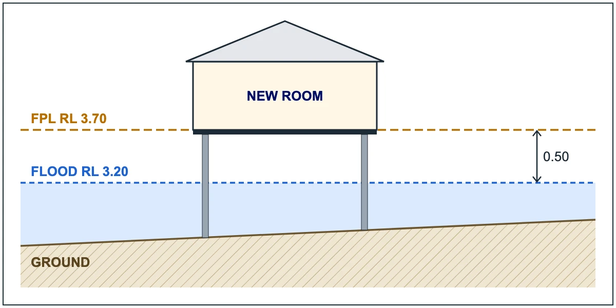
Turning a flood level into a floor height
This is the step the map cannot do for you. Council's certificate notes say flood levels are reduced to the Australian Height Datum, which means they are heights above sea level, and that they "can be compared to ground levels determined by a surveyor using the same datum to ascertain the likely flood depth".
In practice, the certificate gives you a number such as a flood level in metres AHD. A survey of the site gives the ground levels, the existing floor levels and the features around them, all in metres AHD. Put the two together and your designer can show exactly where the new floor sits against the flood planning level.
Council's standard DA lodgement requirements ask for a site survey that shows the boundaries, the levels and contours of the site using AHD, buildings on the site and next door, easements and trees. Our survey of your site's levels and features covers that, and the same levels later guide the set-out of the new work on site.
What to give your designer:
- The Flood Information Certificate for the property.
- A survey of the site's levels to AHD, with existing floor levels and the existing building area.
- Any DCP section your certificate refers to.
Building or extending on flood-affected land? Send us the address and a short note about your plans. Our licensed land surveyors will tell you what survey your designer needs and quote it, free.
GET A FREE SITE LEVELS SURVEY QUOTE CALL (02) 4003 6416
On the form, choose Detail Survey. Rated 5.0 on Google from 4 reviews.
Frequently asked questions
Can the flood information for my property change?
Yes. Council says flood information for a property may be updated at any time, and it is carrying out a new flood study for the Hexham and Woodberry Swamp catchments. A DA also needs a certificate issued within the last 12 months.
Can I use a complying development certificate on flood-affected land?
Sometimes. Under the Housing Code in the State Environmental Planning Policy (Exempt and Complying Development Codes) 2008, complying development cannot be carried out on a flood control lot unless the council or a hydraulic engineer certifies that the part of the lot being developed is not a flood storage area, floodway, flow path, high hazard area or high risk area. Habitable rooms must also meet any minimum floor level in council's development control plan, and other flood standards apply, including flood compatible materials at or below the flood planning level. Council's complying development criteria certificate is the one to order for a CDC.
I am in Lake Macquarie. Does this apply?
Not City of Newcastle's rules. Lake Macquarie is a separate council with its own development control plan. It offers a free Property Flooding Information tool and a paid Flood Certificate that includes its flood planning level requirements, with information only where it has completed a detailed flood study. Start with Lake Macquarie's flood development page.
How much does the survey cost and how long does it take?
Our guide for a survey of a site's levels and features is $1,200 to $3,500+, depending on the property's size, complexity and terrain, and most are completed within 5 to 7 business days from booking, including fieldwork and the plan. Send us the address for a free quote.
Before you lodge
- Check the address on council's flood information viewer.
- Order the right Flood Information Certificate early, and make sure it is less than 12 months old when you lodge a DA.
- Have the site surveyed to AHD, including existing floor levels and the building area.
- Give the certificate and the survey to your designer before the layout is fixed.
City Surveyors Newcastle provides surveys across Newcastle and the Hunter Region.
Get the levels right before the plans are drawn. Tell us the address and what you are building. We will tell you which survey you need and send a free quote.
GET A FREE SITE LEVELS SURVEY QUOTE CALL (02) 4003 6416
On the form, choose Detail Survey. Rated 5.0 on Google from 4 reviews.
Sources checked 10 November 2026: City of Newcastle flooding page, Flood Information application page and certificate notes; Newcastle Development Control Plan 2023 sections B1(a) and B1(b); City of Newcastle DA lodgement requirements; State Environmental Planning Policy (Exempt and Complying Development Codes) 2008 (in-force text as at 9 August 2025); Lake Macquarie City Council. General information only, not planning advice.